


Les confins la tête de Danay

JYDel
User

Length
9.4 km

Max alt
1715 m

Uphill gradient
360 m
Km-Effort
14.6 km

Min alt
1364 m

Downhill gradient
473 m
Boucle
No
Creation date :
2025-02-06 09:31:53.708
Updated on :
2025-02-06 15:01:54.744
3h00
Difficulty : Medium

FREE GPS app for hiking
 SityTrail
IGN / Geographical institutes
SityTrail Plus
The world is yours!
About
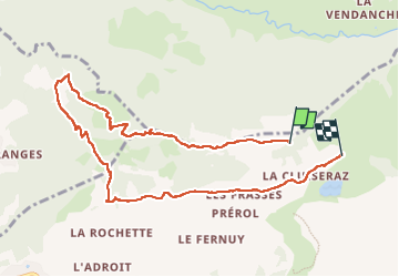
Trail Walking of 9.4 km to be discovered at Auvergne-Rhône-Alpes, Upper Savoy, La Clusaz. This trail is proposed by JYDel.
Positioning
Country:
France
Region :
Auvergne-Rhône-Alpes
Department/Province :
Upper Savoy
Municipality :
La Clusaz
Location:
Unknown
Start:(Dec)
Start:(UTM)
303782 ; 5088352 (32T) N.
Comments